So, you’re thinking about heading to Alaska, huh? It’s a truly amazing place, super wild and beautiful. But it’s also huge, and if you want to really see it, you’re going to need some good maps. I mean, more than just your phone. Knowing how to use maps of Alaska can make your trip way better and safer. We’re going to talk about all sorts of maps, from the ones that show you where the roads are to special maps for finding wildlife or exploring national parks. Get ready to plan your big adventure!
Key Takeaways
- Alaska has all sorts of land, like mountains and tundra, and each part has its own adventures.
- Maps like the National Geographic Adventure Map are super helpful for getting around Alaska’s huge wilderness.
- It’s a good idea to know the layout of places like Denali National Park before you go.
- Special wildlife maps can point you to the best spots to see Alaska’s unique animals.
- Using apps and GPS can really help you find your way, especially in remote areas.
Understanding The Geography Of Alaska

Alaska is enormous. Seriously, it’s probably bigger than you think. Before you even start planning a trip, it’s important to understand its geography. It’s not just about knowing where Anchorage is; it’s about understanding the sheer size and variety of the landscape. This knowledge will help you choose the right maps and equipment, and it will make your adventure much more rewarding.
Key Takeaways
Here’s a quick rundown of some key geographical facts:
- Alaska is the largest state in the US. It’s so big, it’s hard to wrap your head around. It’s roughly double the size of Texas!
- It has more coastline than all other US states combined. Think about that for a second. All those beaches and inlets!
- It’s home to the highest peak in North America (Denali). Denali is a beast of a mountain, and it dominates the landscape.
- Alaska’s diverse geography includes mountains, forests, and tundra, each offering unique adventures. From temperate rainforests to arctic tundra, Alaska has it all.
- Understanding the layout of national parks, such as Denali and Glacier Bay, is important for planning your visit. Each park has its own unique features and challenges.
Geographical Facts
Alaska is truly massive. It could swallow up Texas, California, and Montana and still have room to spare. That’s why understanding its geography is so important. You’re not just dealing with a state; you’re dealing with a continent in miniature. The National Map provides access to essential geospatial data, including foundational topographic layers such as elevation, hydrography, and geographic names.
Here’s a quick rundown of some key geographical facts:
- Alaska is the largest state in the US, roughly double the size of Texas and four times larger than California.
- It has more coastline than all other US states combined. You can experience breathtaking Talkeetna Heli-Hike tours near Anchorage, Alaska.
- It’s home to the highest peak in North America (Denali).
Seriously, Alaska is massive. It could swallow up Texas, California, and Montana and still have room to spare. That’s why understanding its geography is so important. You’re not just dealing with a state; you’re dealing with a continent in miniature.
Essential Maps Of Alaska For Adventurers

Alaska is a huge playground for those who love adventure, and having the right maps can really change your experience. Whether you’re thinking about a tough hike, a relaxing fishing trip, or some exciting skiing, detailed maps are super important. Let’s check out some map options.
National Geographic Adventure Map
This map is a solid choice for almost any adventure. It gives you a ton of detail, showing everything from the rainforests to the arctic tundra. It clearly marks national parks, forests, reserves, and wildlife refuges. Plus, it’s printed on paper that can handle water and won’t tear easily, which is a must with Alaska’s crazy weather. It’s also great to see the Alaska Parks tapestry on this map.
Alaska Wildlife Viewing Map
If you’re hoping to see some of Alaska’s amazing animals, this map is for you. It points out the best spots to see bears, moose, whales, and birds. It also gives you info on when these animals move around during the year, so you know when and where to look. It’s not just about where to find them, but also about understanding their patterns. For example, you might find that certain areas are better for Prince William Sound tours during specific times of the year.
Here’s a quick list of what this map usually includes:
- Locations of wildlife viewing areas
- Best times to view different species
- Safety tips for wildlife viewing
Having a good map, whether it’s on paper or on your phone, can really make a difference when you’re out exploring Alaska. It helps you stay safe, find the best spots, and really enjoy your time in the wilderness. Don’t leave without one!
Planning Your Route With Alaska Road Maps

Alaska Highway Map
Planning a trip on the Alaska Highway? It’s quite the journey! This historic route is over 1,300 miles of amazing views. You’ll want a good map showing all the towns, rest areas, and cool spots along the way. I remember one time we used a basic map and missed a turn for some awesome hot springs. Don’t let that happen to you! A detailed map, like the one in this guide, is super important.
Scenic Byways
Alaska has some really incredible scenic byways that are worth checking out. These roads take you through some of the prettiest parts of the state. For example, the Glenn Highway has views of glaciers and mountains, and the Seward Highway goes right along the coast. Make sure your map shows these scenic routes so you don’t miss them. I like to mark the byways I want to drive on my map before I leave, so they’re easy to find. You can find a guide for road trippers online.
Local Road Conditions
One thing you should know about driving in Alaska is that road conditions can change fast. What starts as a smooth drive can quickly turn into a bumpy one. It’s a good idea to check local road conditions before you leave. Your map might not show the latest construction or closures, so it’s important to stay up-to-date. You can usually find updates on the Alaska Department of Transportation website. Also, a reliable travel planner can be a lifesaver. You can use Google Maps to plan your trip.
Driving in Alaska is different than driving in the lower 48. You need to be ready for anything. That means having a good map, knowing the road conditions, and being ready for unexpected delays. It’s all part of the adventure!
Adventure Maps For Outdoor Activities
Alaska is a huge playground for anyone who loves being outside, and having the right maps can really change your whole experience. Whether you’re thinking about a tough hike, a chill fishing trip, or some awesome skiing, good maps are super important. Let’s check out some of the main types of maps you might want to grab.
Trail Difficulty Ratings
When you’re planning a hike, you need to know what you’re getting into. Maps that show trail difficulty are a must. They usually use a simple system like easy, moderate, and difficult. This helps you pick a trail that matches your skill level and what you’re up for. I remember one time, I didn’t check the difficulty and ended up on a trail that was way too hard. It turned a fun day into a total struggle. Also, look for maps that show elevation changes. Those can be sneaky!
Backcountry Access Points
If you’re heading into the backcountry, you need to know where you can actually get in. Maps showing backcountry access points are key. These maps will show you where the trailheads are, where you can park, and any permits you might need. It’s also good to look for maps that show water sources and campsites. I always use Alaska’s National Forests to plan my backcountry trips.
Avalanche Zones
If you’re out in the mountains during the winter, you have to know about avalanche zones. Avalanche maps show you areas that are at risk of avalanches. These maps use colors or symbols to show the level of risk. It’s super important to pay attention to these maps and avoid avalanche zones if you’re not trained and equipped to handle them. Always check the avalanche forecast before you go out. You can find hiking trails that are safe even in winter if you plan ahead.
I can’t stress enough how important it is to be prepared when you’re out in the Alaskan wilderness. Maps are a great tool, but they’re not a substitute for common sense and good judgment. Always let someone know where you’re going, and be ready for anything.
Cultural Maps Highlighting Alaska’s Heritage
Alaska’s cultural heritage is super interesting, especially because of the many different Native groups that call it home. Maps that focus on this stuff aren’t just about finding your way; they’re like little portals that help you understand Alaska’s past and present. They show you where different groups lived, where important events happened, and where you can still experience the rich culture today.
Native Alaskan Tribes Map
These maps are really helpful if you want to understand where different Native groups in Alaska are located. They often show the traditional lands of tribes like the Tlingit, Haida, Athabascan, Yup’ik, and Inupiat. These maps can also include information about language families and cultural regions. You can even find interactive maps showcasing American Indian languages and territories.
Historical Sites
Alaska’s history is full of cool stories, from the gold rush days to its role in World War II. A historical sites map points out places that were important, like old mining towns, battlefields, and trading posts. These maps help you connect with the past and see how Alaska’s history made it what it is today. You can find a variety of maps and related information addressing various topics such as climate change, economy, and health.
Cultural Landmarks
Cultural landmarks are spots that mean a lot to Alaskans, showing off their traditions, beliefs, and art. These maps can lead you to Native cultural centers, museums, and cool art displays. They give you a chance to see Alaska’s culture up close. The Alaska Museum Map offers precise locations of museums throughout Alaska.
Exploring Alaska’s cultural maps provides a deeper appreciation for the state’s heritage. It’s a way to connect with the stories of its people and understand the forces that have shaped its unique identity. By using these maps, travelers can move beyond the typical tourist experience and engage with Alaska’s cultural landscape in a meaningful way.
Exploring Alaska’s Coastal Regions
Alaska’s coastline is seriously long, longer than all the other U.S. states combined. That’s a lot of shoreline to explore! From the Inside Passage to the Kenai Fjords, there’s a ton to see. You’ll definitely want some good maps for this part of your adventure.
Inside Passage Map
The Inside Passage is this amazing network of waterways winding through islands and forests. A good map here is super useful for figuring out ferry routes, finding small towns, and spotting wildlife. It’s basically your key to unlocking the beauty of Southeast Alaska.
Kenai Fjords National Park
Kenai Fjords is all about glaciers and marine life. You’ll want a map that shows you where the major glaciers are, like Exit Glacier, and all the bays and inlets where you can see whales, sea otters, and seals. I remember taking a Prince William Sound tour a few years back, and the map they gave us was so helpful for spotting wildlife.
Coastal Navigation Tips
Exploring the coast can be tricky. Here are a few things to keep in mind:
- Tides matter. A lot. Check tide charts before you head out, especially if you’re planning on hiking along the shore or kayaking.
- Weather changes fast. Like, really fast. Be prepared for rain, wind, and fog, even if the sun is shining when you start.
- Cell service can be spotty. Don’t rely on your phone for navigation. Bring a paper map and a compass, and know how to use them. You can also use mobile mapping applications for offline navigation.
Seriously, Alaska’s coast is incredible, but it demands respect. Plan ahead, be prepared for anything, and you’ll have an amazing time. Don’t forget to check out the Alaska Coastal Current for more details.
Navigating Alaska’s National Parks
Alaska’s national parks are huge and diverse, which means you need to plan carefully and have good maps. You can’t just show up without a plan; well, you can, but I wouldn’t suggest it. Let’s check out some key parks and what you need to know to get around.
Denali National Park
Denali is probably the most well-known, and for good reason. It’s home to Denali, North America’s highest peak. The park itself is massive, and a lot of it is wilderness. The Alaska National Parks Map is super important because much of the park is only accessible by bus or on foot. The map will show you the bus routes, hiking trails, and where the visitor centers are. Also, pay attention to the backcountry camping zones if you’re planning on roughing it. You’ll need permits for those, and the map will help you figure out where you can and can’t camp. It’s also a good idea to check out the park system for more information.
Wrangell-St. Elias National Park
Wrangell-St. Elias is the biggest national park in the US. It’s so big, it’s almost overwhelming. This park is rugged, remote, and seriously wild. A detailed map is absolutely essential. Look for maps that show the topography, the major rivers, and the location of old mining camps and other historical sites. Many areas are only accessible by plane or a very long hike, so planning is key. If you’re thinking about doing any backcountry travel, make sure you have a map that shows the different access points and potential hazards. You might even consider a Eklutna Glacier tour for transport to remote areas.
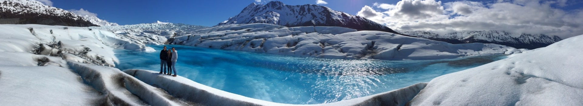
Glacier Bay National Park
Glacier Bay is a totally different experience. It’s all about water, glaciers, and wildlife. A good map of Glacier Bay will show you the waterways, the glaciers (obviously), and the areas where you’re most likely to see whales, seals, and other marine life. Many people explore Glacier Bay by boat, so nautical charts are really helpful here. You can also find maps that highlight the different cruise routes and kayak routes. If you’re planning on doing any hiking, make sure your map shows the trails and any potential hazards. Don’t forget to check out Alaska’s Inside Passage for more details. Also, be sure to check the Glacier Bay boating regulations before you go.
When exploring Alaska’s national parks, always remember that weather conditions can change rapidly. Carry a map, compass, and GPS, and know how to use them. Tell someone where you’re going and when you expect to be back. And be prepared for anything. Alaska is an amazing place, but it demands respect.
Leveraging Digital Maps And Technology
Alaska’s vast landscapes demand smart tools. Let’s explore how technology can be your friend, moving beyond traditional paper maps.
Mobile Mapping Applications
Your smartphone can be a powerful mapping tool. Download apps like Gaia GPS or Avenza Maps. These let you download maps for offline use. Plus, you can record tracks, add photos, and share your adventures. Just remember to conserve battery! A power bank is a must. I like using my phone for quick checks, but I always have a backup GPS, too. These apps are great for planning adventure tours as well.
GPS Devices
GPS devices are super useful. They offer real-time location tracking, even without cell service. Pre-load maps, mark waypoints, and stay on course. It’s a game changer for backcountry trips. I remember one time, my GPS saved me from getting totally lost in Denali; wouldn’t go without it now. Consider investing in a rugged, waterproof model. You can even find 3DEP data for Alaska to load onto some devices.
Satellite Imagery
Satellite imagery provides a bird’s-eye view of Alaska’s terrain. Services like Google Earth offer high-resolution images. This helps you scout areas, identify potential hazards, and plan routes. It’s like having a personal spy satellite! I use it to check out river crossings and potential campsites before I even leave home. It’s also helpful for seeing how communities in Southeast Alaska are using lidar technology to map landslide risks.
Don’t rely solely on technology. Batteries die, signals get lost, and devices fail. Always carry a traditional map and compass, and know how to use them. It could save your life.
Safety Considerations When Using Maps Of Alaska
Alaska is beautiful, but it can be dangerous. Maps are super helpful, but they don’t solve everything. You need to be smart and prepared. Let’s talk about some safety stuff to keep in mind when you’re using maps in Alaska.
Understanding Terrain Challenges
Alaska’s terrain is no joke. It’s huge, rough, and can change fast. Maps are great, but they don’t show everything. You need to be able to read the land. Elevation changes, thick forests, and unpredictable rivers can mess up your plans. Always check your map against what you see. It’s easy to get lost, especially if the weather gets bad. For example, if you’re planning a trip to Hatcher Pass, make sure you understand the terrain before you go.
Weather Preparedness
Speaking of weather, Alaska’s weather is wild. Sunny one minute, blizzard the next. Your map won’t tell you a storm is coming. Always check the forecast before you leave, and be ready for changes. Pack extra clothes, waterproof stuff, and emergency supplies. Knowing how to use your map and compass when you can’t see well is a must. Understanding weather patterns is key for Alaska’s Inside Passage.
Emergency Contact Information
Before you head out, make sure someone knows your plans. Tell a friend, family member, or ranger where you’re going. Include your route, when you’ll be back, and who to call if something goes wrong. Carry a satellite phone or a personal locator beacon (PLB) in case you need help. And know how to use them! It’s useless to have fancy tech if you don’t know how to send an SOS. You can find traveler information on Alaska.gov.
Where To Find Your Maps Of Alaska
Online Resources
The internet is a treasure trove when you’re looking for maps. You can find pretty much any kind of map you need online. I usually start with a general search, but sometimes it’s good to check out specific sites. For example, if you’re interested in community data, you might want to check out a community profile map. It’s super convenient to just download what you need, but always double-check the source to make sure the map is accurate and up-to-date. Also, consider if you’ll have reliable internet access on your trip – if not, downloading before you go is a must!
Local Visitor Centers
When you get to Alaska, make sure to stop by the local visitor centers. These places are amazing for getting maps and local advice. The people who work there are super knowledgeable about the area and can point you to the best resources. You can often get free maps and brochures that are really helpful. They might even have maps that you can’t find anywhere else. Don’t be afraid to ask questions; they’re there to help you out! If you’re planning a trip on the Alaska Railroad, they can provide specific maps and schedules.
Bookstores And Outdoor Retailers
Don’t forget about buying maps from bookstores and outdoor stores. You can find a good selection of maps that are waterproof and tear-resistant. These maps are great for planning your route. Plus, having a physical map is always a good backup, especially if you’re going somewhere with limited cell service. You can find a large print political map that’s easy to read, or even customize your own US state maps. I like to have both digital and paper maps just in case. It’s also a good idea to check out a Rand McNally Alaska map for updated road information.
Getting your hands on the right maps is a key part of planning any trip to Alaska. Whether you prefer digital maps, physical copies, or a mix of both, there are plenty of resources available to help you explore this amazing state safely and confidently.
Final Thoughts On Your Alaskan Adventure

Alaska is truly a place of incredible beauty and vast wilderness. Having the right maps can make all the difference. Whether you’re planning a trip to Alaska or just dreaming about it, remember a few key things.
Planning Is Key
Good planning is super important for an Alaskan adventure. It’s not just about picking destinations; it’s about understanding the terrain, weather, and resources available. Start by figuring out what you want to see and do. Research the best times to visit for those activities. Then, look at the maps available and plan your route. Don’t forget to factor in travel times, which can be longer than you think in Alaska. For example, if you’re thinking about a 10-day Alaska itinerary for a road trip, map out each day’s journey in advance.
Flexibility Is Important
Even with the best plans, things can change. Weather can shift quickly, roads can close, and wildlife might decide to show up where you least expect it. Being flexible is key to enjoying your trip. Have backup plans and be ready to adjust your itinerary as needed. Talk to locals for up-to-date information and be open to new experiences. Sometimes, the best adventures are the ones you didn’t plan. If you’re driving, be sure to check local road conditions.
Unforgettable Memories
Alaska has a way of creating memories that last a lifetime. From the stunning landscapes to the unique wildlife and the friendly people, there’s something special about this place. Take the time to soak it all in. Whether you’re hiking in Denali, kayaking in Kenai Fjords, or simply enjoying the view from a scenic overlook, be present in the moment. These are the moments you’ll remember long after you’ve left. Consider a Talkeetna Heli-Hike tour for a truly unforgettable experience.
Getting the right maps is a key part of planning any trip to Alaska. Whether you prefer digital maps, physical copies, or a mix of both, there are plenty of resources available to help you explore this amazing state safely and confidently.
As you think about your amazing trip to Alaska, remember that there’s so much more to see and do. Don’t let your adventure end here! Visit our website to discover even more exciting travel ideas and plan your next unforgettable journey.
Wrapping Up Your Alaska Trip
So, that’s pretty much it! Alaska is a really big and beautiful place, and having the right maps can make a huge difference. Whether you’re hiking up a mountain, cruising along the coast, or just checking out small towns, these maps will help you get around. Don’t forget to bring your sense of adventure and a good camera. You’ll want to take pictures of everything. Remember, getting ready is good, but being able to change your plans is just as important. Have a great time, and I hope your Alaska trip is full of good memories!
Frequently Asked Questions
What are the main geographical features of Alaska?
Alaska is a huge state with lots of different kinds of land. You’ll find tall mountains, thick forests, winding rivers, and wide-open tundra. It’s like many different places all rolled into one, from the cold Arctic to rainy coastal areas.
What is the best map for adventure in Alaska?
For general exploring, the National Geographic Adventure Map is a top pick. It shows you parks, places where you can see animals, and other cool spots to visit.
How do I find my way around Alaska’s national parks?
Each national park in Alaska has its own special map. For example, Denali National Park has a map that points out hiking paths and camping spots.
What should I know about Alaska’s coastal regions?
The Inside Passage Map is super helpful for checking out the coast. It highlights amazing places like Kenai Fjords and the charming towns along the water.
Can I use digital maps and technology for navigation?
Yes, you can use apps on your phone and GPS devices to help you navigate, especially in places where there’s no cell service. Satellite pictures can also give you a good look at the land from above.
What safety tips should I keep in mind when using maps in Alaska?
It’s really important to understand that Alaska’s land can be tricky. Maps are useful, but you also need to pay attention to the actual ground, weather changes, and always have a plan for emergencies.
Where can I get maps for my trip to Alaska?
You can find maps online, at local visitor centers (they often have free ones!), and in bookstores or outdoor gear shops.
Are there maps that show Alaska’s cultural heritage?
Yes, some maps show where different Native Alaskan groups live and important cultural spots. These maps help you learn about Alaska’s history and people.