Planning a trip to Alaska? You’ll want to make sure you have the best printable map of Alaska to guide your adventures. With so much to explore, from stunning national parks to vibrant cities, having a reliable map can make all the difference. This article will help you choose the right map, find top sources, and even customize your own for a truly unique experience.
Key Takeaways
- Choose the right type of map for your needs, whether it’s digital or paper.
- Explore reliable sources for printable maps, including state resources and tourism offices.
- Familiarize yourself with major Alaskan cities and their attractions using maps.
- Plan your road trip with scenic routes and essential stops in mind.
- Utilize maps for outdoor activities like hiking and wildlife viewing.
Choosing The Right Printable Map Of Alaska
Understanding Different Map Types
Okay, so you’re planning an Alaska trip and need a map. Makes sense! But before you just grab the first one you see, it’s good to know there are different kinds. There are road maps, which are great for driving, showing highways and towns. Then you’ve got topographic maps, which are super useful for hiking because they show elevation changes. And don’t forget specialized maps for things like fishing spots or hiking trails. Picking the right type depends on what you’re actually planning to do.
Digital vs. Paper Maps
This is a big one these days. Digital maps on your phone or GPS are convenient, sure. But what happens when you’re out in the middle of nowhere and your battery dies, or there’s no signal? That’s where paper maps come in. A paper map doesn’t need batteries, and you can mark it up, highlight routes, and make notes. It’s a good idea to have both, honestly. Use the digital map when you can, but always have a paper backup. Plus, there’s something satisfying about unfolding a big map and planning your adventure the old-fashioned way.
Features To Look For In A Map
So, what makes a good map? Well, first off, accuracy is key. You want a map that’s up-to-date and reliable. Look for maps that clearly show roads, trails, and landmarks. A good legend is also important, so you can understand the symbols and markings. If you’re planning on doing any snow machine recovery, make sure the map shows terrain details. Also, consider the scale of the map. A larger scale map will show more detail, but it might not cover as much area. Think about what you need the map for and choose accordingly. A travel map can be a great starting point.
Ultimately, the best map is the one that works best for you. Consider your planned activities, your comfort level with technology, and the level of detail you need. Don’t be afraid to get a couple of different maps to cover all your bases. And remember, a map is just a tool – it’s up to you to use it to create an amazing Alaskan adventure.
Top Sources For Printable Maps

Official State Resources
When planning a trip to Alaska, one of the first places to check for maps is official state resources. These sources often provide accurate and up-to-date maps for various purposes, from road travel to recreational activities. The Alaska Department of Natural Resources, for example, might have geological survey maps available. You can often find free downloadable maps on state websites, covering everything from hiking trails to public lands. Don’t forget to check out the Alaska State Large Print Wall Map for a detailed view of the state’s geography.
Travel Websites
Travel websites are another great place to find printable maps of Alaska. These sites often cater to tourists and offer a range of maps tailored to popular destinations and activities. You might find maps highlighting scenic routes, points of interest, and essential services. Many travel websites also provide interactive maps that you can customize and print. For example, if you’re planning a Talkeetna Heli-Hike tour, the tour operator’s website might offer a printable map of the area.
Local Tourism Offices
Local tourism offices are goldmines for detailed, specialized maps. These offices are dedicated to promoting tourism in their specific regions and often have maps that highlight local attractions, trails, and points of interest that you won’t find on more general maps. Plus, the people who work there are usually super knowledgeable and can give you tips on the best places to visit. You can usually find these maps at visitor centers, or sometimes you can download them from the tourism office’s website. Make sure to check out the Alaska Digital Archives for historical maps and resources.
Getting maps from local tourism offices is a great way to support the local economy and get insider tips for your trip. These maps often include information about local events, festivals, and hidden gems that you won’t find anywhere else.
Exploring Alaska’s Major Cities

Anchorage Map Highlights
Anchorage is a cool mix of city life and wild nature. You can literally see moose in the morning and catch a ballet in the evening. It’s also a great starting point for trips around Alaska. When you’re checking out Anchorage, here are a few spots you might want to put on your map:
- The Tony Knowles Coastal Trail: Perfect for biking or walking with awesome views.
- The Anchorage Museum: Learn about Alaska’s art, history, and science.
- Flattop Mountain: A popular hike that gives you a great view of the city.
Anchorage uniquely combines the conveniences of the modern world in its rugged, natural environment. Many travelers fly into and out of Anchorage, so you’ll likely have some time automatically built into your itinerary to experience the state’s largest city.
Fairbanks Navigation Tips
Fairbanks is Alaska’s second-biggest city, and it’s got a gold rush past mixed with a modern university vibe. It’s got a fiercely independent spirit. To get around, keep these tips in mind:
- Summer is the best time to visit, with long daylight hours.
- The University of Alaska Museum of the North is a must-see.
- Take a riverboat cruise on the Chena River for a different view of the city.
Juneau’s Key Attractions
Juneau, the capital of Alaska, is unique because you can’t drive there – you have to fly or take a boat. It’s surrounded by mountains and the ocean, which makes it super scenic. Here’s what to check out:
- Mendenhall Glacier: You can walk right up to it!
- Mount Roberts Tramway: Ride up for amazing views and hiking trails.
- The Alaska State Museum: Learn about the state’s history and culture. Don’t forget to check out the Alaska map stock photos before you go to get a feel for the area.
Navigating Alaska’s National Parks

Alaska’s national parks are vast and often remote, making detailed maps absolutely essential for any visit. Having the right map can be the difference between a safe, enjoyable trip and a potentially dangerous situation. Let’s explore some key parks and the map resources available.
Denali National Park Map
Denali is huge, and most of it is wilderness. The official park service map is a good starting point, but it doesn’t show everything. For serious hiking or backpacking, you’ll want something more detailed. Consider these points when planning your trip:
- Road Access: The Denali Park Road is the main artery, but private vehicles are restricted past a certain point. The map will show you where you can drive and where you need to take a bus.
- Trail Systems: While there are established trails near the entrance, most of the park is trailless. A topographic map is crucial if you plan to venture off-trail.
- Campgrounds: Know where the campgrounds are located and how to reserve them. The park map will indicate their locations, but check the park’s website for reservation details.
Planning a trip to Denali requires careful consideration of the park’s vastness and limited infrastructure. A detailed map is not just a tool, it’s a companion that helps you understand the landscape and make informed decisions about your route and activities.
Kenai Fjords Exploration
Kenai Fjords is a different beast altogether. It’s a maritime park, so much of the exploration is done by boat. However, maps are still important. Here’s why:
- Boat Tours: Even on a guided tour, a map can help you understand the geography of the fjords and where you’re going. Look for maps that highlight wildlife viewing areas.
- Kayak Trips: If you’re kayaking, a waterproof map is a must. Tides, currents, and weather can change quickly, and you need to be able to navigate safely. Consider single maps for comprehensive coverage.
- Hiking: There are some hiking trails near the visitor center and on some of the islands. A trail map will help you explore these areas.
Wrangell-St. Elias Insights
Wrangell-St. Elias is the largest national park in the US. It’s so big that it contains entire mountain ranges! This park demands respect and careful planning. Here’s what to keep in mind:
- Remoteness: This park is extremely remote. Services are limited, and weather can be unpredictable. A detailed topographic map and the ability to use a compass are essential.
- Glaciers: Glaciers are constantly changing. Maps may not always be up-to-date, so be prepared for unexpected obstacles. Consider a geological research tour to better understand the landscape.
- Accessibility: Many areas of the park are only accessible by plane or a very long hike. Plan your route carefully and be prepared for self-sufficiency. You can even explore activity tours via helicopter for a unique perspective.
Here’s a simple table to summarize map needs for each park:
| Park | Key Map Features | Activities | Potential Hazards |
|---|---|---|---|
| Denali | Topographic, trail, campground locations | Hiking, backpacking, bus tours | Wildlife encounters, changing weather |
| Kenai Fjords | Waterproof, wildlife viewing areas, tide charts | Boat tours, kayaking, hiking | Tides, currents, sudden weather changes |
| Wrangell-St. Elias | Detailed topographic, compass skills required | Hiking, backpacking, mountaineering, flying | Remoteness, glaciers, unpredictable weather, limited services |
Remember to always check with the park service for the most up-to-date information and park brochure before heading out. Have fun, and stay safe!
Planning Your Road Trip With Maps
Alaska is calling, and what better way to answer than with a road trip? But before you hit the open road, let’s talk maps. A well-planned route, combined with the right maps, can make all the difference between an unforgettable adventure and a stressful ordeal. I’ve done a few Alaska road trips, and trust me, preparation is key. You don’t want to rely solely on your phone’s GPS when you’re miles from civilization. Let’s get into the details.
Best Scenic Routes
Alaska is packed with scenic routes, each offering its own unique charm. The Seward Highway, for example, is a stunner, winding along the coast with views of glaciers and mountains. Then there’s the Parks Highway, which takes you from Anchorage to Fairbanks, right past Denali National Park. Don’t forget the Glenn Highway, either. It’s less traveled but equally beautiful. When planning, consider:
- Seward Highway: Anchorage to Seward, about 125 miles. Perfect for glacier and wildlife viewing.
- Parks Highway: Anchorage to Fairbanks, roughly 360 miles. Offers access to Denali National Park.
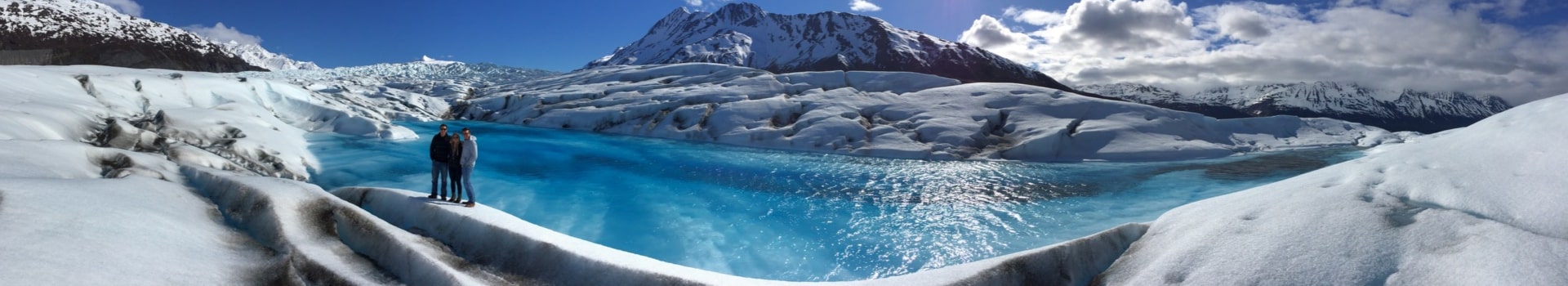
- Glenn Highway: Anchorage to Glennallen, around 186 miles. Known for its mountain vistas and Matanuska Glacier.
I always recommend doing some research and picking a route that matches your interests. Are you into wildlife? Glaciers? Mountains? Alaska has it all, but you need to choose the right road to see it.
Essential Stops Along The Way
No road trip is complete without some awesome stops. In Alaska, these can range from quirky small towns to breathtaking natural wonders. Here are a few must-sees:
- Talkeetna: A charming town near Denali, perfect for flightseeing tours. Consider a Talkeetna Heli-Hike.
- Matanuska Glacier: You can actually walk on this glacier! Guided tours are available.
- Denali National Park: Obviously, a must-see. Plan for at least a day or two to explore.
Also, don’t forget to check out local visitor centers. They’re packed with information and can point you to hidden gems you won’t find in any guidebook. I always make it a point to stop at these. You can also find Alaska Road Guides online.
Safety Tips For Driving
Driving in Alaska is different than driving in the lower 48. The distances are vast, the weather can be unpredictable, and wildlife is abundant. Here are some safety tips to keep in mind:
- Check the weather forecast: Conditions can change rapidly, especially in the mountains.
- Carry extra supplies: Food, water, warm clothes, and a first-aid kit are essential.
- Watch out for wildlife: Moose and caribou often cross the road, especially at dawn and dusk.
- Tell someone your route: Let a friend or family member know your plans and check in regularly.
Also, make sure your vehicle is in good condition before you leave. Get a tune-up, check your tires, and make sure you have a spare tire and the tools to change it. Cell service can be spotty, so don’t rely on your phone for everything. Consider renting a satellite phone or a personal locator beacon (PLB) for emergencies. You can also find telecommunications support near Anchorage.
Using Maps For Outdoor Adventures
Alaska is an outdoor paradise, and a good map is your best friend out there. Whether you’re planning a challenging hike, a relaxing fishing trip, or hoping to spot some amazing wildlife, having the right map can make all the difference. Let’s get into how to use maps to make your Alaskan adventures unforgettable.
Hiking Trails and Maps
When it comes to hiking, a detailed topographic map is non-negotiable. These maps show elevation changes, water sources, and terrain features that can be critical for planning your route and staying safe. I always make sure to cross-reference my paper map with a GPS app on my phone, but I never rely solely on technology, especially in areas with spotty cell service. It’s also a good idea to check recent trail reports for any closures or hazards. For example, if you’re planning a Talkeetna Heli-Hike, you’ll want a map that shows the glacier’s current conditions.
Fishing Locations
Finding the best fishing spots in Alaska often means venturing off the beaten path. Fishing maps can be incredibly helpful, showing you river access points, lake depths, and even areas known for specific fish species. Local knowledge is invaluable, so I always try to chat with anglers at tackle shops or online forums before heading out. Remember to check the Alaska Department of Fish and Game website for the latest regulations and restrictions. I’ve found that combining a good map with local tips dramatically increases my chances of landing a big one.
Wildlife Viewing Areas
Alaska is teeming with wildlife, but knowing where to go is key. Maps highlighting wildlife viewing areas can point you to places where you’re more likely to see bears, moose, eagles, and other amazing creatures. However, it’s super important to remember that these are wild animals, and you need to keep a safe distance. Always carry bear spray and know how to use it. I also like to use binoculars and a spotting scope to get a better view without getting too close. Consider a flightseeing tour for a unique perspective on Alaska’s wildlife.
A map is more than just a piece of paper; it’s a tool that can unlock incredible experiences. It helps you plan, stay safe, and connect with the natural world in a meaningful way. So, grab a map, do your research, and get ready for an adventure you’ll never forget.
Customizing Your Printable Map Of Alaska

Adding Personal Notes
Okay, so you’ve got your blank outline map of Alaska. Now what? Time to make it yours. Adding personal notes is a great way to transform a generic map into a useful tool tailored to your specific trip. Jot down important phone numbers, addresses of friends you plan to visit, or even just funny memories from past trips to the same area.
- Use a fine-tipped pen for legibility.
- Consider color-coding your notes for different categories (e.g., red for emergency contacts, blue for lodging).
- Don’t overcrowd the map; keep it clean and easy to read.
Highlighting Points Of Interest
Highlighting points of interest is a game-changer for trip planning. Think about what you really want to see and do. Are you into wildlife? Mark those prime wildlife viewing areas. History buff? Pinpoint historical sites. Foodie? Circle those must-try restaurants. Grab some highlighters or colored pencils and go to town. Just remember to use different colors for different types of attractions to keep things organized. For example, you might use green for parks, blue for water-related activities, and orange for historical landmarks. This way, at a glance, you can see what’s available in a given area.
Creating Itineraries
Creating itineraries directly on your map can be super helpful. Instead of flipping through a separate notebook, you can see your entire plan laid out visually. Here’s how I usually do it:
- Start by marking your starting and ending points.
- Draw lines connecting the places you want to visit, indicating the order.
- Write estimated travel times between locations.
I like to use a dashed line for optional routes or detours. This gives me flexibility if I decide to change my plans on the fly. Plus, it’s a great way to see the big picture of your trip and make sure you’re not trying to cram too much into one day. You can even use different colored markers to represent different days of your trip. For example, day one could be in blue, day two in green, and so on. This makes it easy to see at a glance where you’ll be on any given day.
If you’re planning a road trip, consider using a map that showcases main roads and a topographic landscape design Alaska state map art print poster.
Understanding Alaska’s Geography
Alaska’s geography is HUGE and diverse, which is part of what makes it so interesting to explore. From towering mountains to vast stretches of coastline, understanding the lay of the land is key to planning any trip. You can find a selection of maps to help you get started.
Mountain Ranges and Their Maps
Alaska is home to some seriously impressive mountain ranges. The Alaska Range, home to Denali, is probably the most famous. But there are others, like the Brooks Range and the Chugach Mountains, each with its own unique character. Maps of these ranges are super useful for hikers, climbers, and anyone wanting to understand the topography of the region. The endless Alaska Range is a sight to behold.
Rivers and Lakes
Alaska’s waterways are just as important as its mountains. The Yukon River is a major transportation route, and there are countless lakes scattered across the state. These rivers and lakes aren’t just pretty; they’re vital for fishing, transportation, and supporting wildlife. Maps showing these waterways are essential for planning fishing trips or boat excursions. You can even take helicopter tours to see them from above.
Coastal Areas and Islands
Alaska has more coastline than all the other US states combined! This includes everything from rugged fjords to sandy beaches, plus thousands of islands. Coastal maps are a must for anyone planning a trip to Southeast Alaska or exploring the Aleutian Islands. They’re also important for understanding the state’s maritime history and current fishing industry. Consider a visit to Eklutna Valley for stunning views.
Understanding Alaska’s geography is more than just knowing where things are on a map. It’s about understanding how the land shapes the culture, economy, and way of life in this amazing state. It’s about appreciating the sheer scale and diversity of the landscape, and how it impacts everything from transportation to wildlife habitats. Knowing the geography helps you plan better and appreciate the place more.
Map Resources For Specific Activities
Fishing Maps
Planning a fishing trip in Alaska? You’ll need the right map! Fishing maps are super useful because they show you where the fish are likely to be. These maps often include information about fish species, regulations, and access points. You can find these maps at local sporting goods stores, or from the Alaska Department of Fish and Game. Some maps even highlight popular fishing spots and provide tips from local experts. Don’t forget to check for updated versions, as regulations and fish populations can change.
Hiking and Biking Trails
Alaska is a hiker’s and biker’s paradise, but you can’t just wander around without a good map. Trail maps are a must-have for any outdoor adventure. These maps show you the trails, their difficulty levels, and any points of interest along the way. Many maps also include elevation profiles, which can help you plan your route and avoid any unexpected climbs. You can often find trail maps at visitor centers, ranger stations, or online. Make sure to choose a map that is detailed enough for your needs and that includes information about water sources and potential hazards. You might even find a brochure with trail details to help you plan.
Winter Sports Locations
Alaska in the winter is a whole different world, and you’ll need specialized maps to navigate it safely. These maps highlight areas suitable for skiing, snowboarding, snowmobiling, and other winter activities. They often include information about avalanche risks, groomed trails, and access points. You can find these maps at ski resorts, snowmobile rental shops, or from local outdoor organizations. Always check the weather forecast and avalanche conditions before heading out, and make sure you have the necessary safety equipment. Consider a heli-hike tour for a unique winter experience.
Having the right map can make all the difference in your Alaskan adventure. Whether you’re fishing, hiking, or enjoying winter sports, a good map can help you stay safe and make the most of your time in the great outdoors. Always plan ahead and be prepared for anything!
Tips For Effective Map Reading
Understanding Map Symbols
Alright, so you’ve got your map. Now what? First things first, get familiar with those little pictures and lines – the map symbols. They’re not just random doodles; they represent real-world stuff like campgrounds, hiking trails, or even that elusive moose crossing. Take a moment to study the legend; it’s your key to unlocking the map’s secrets. Without it, you’re basically just looking at a pretty picture.
Using a Compass
Okay, so you know what the symbols mean, but how do you figure out which way is north? That’s where a compass comes in handy. It’s not just for old-timey explorers; it’s a super useful tool, especially in Alaska where cell service can be spotty.
Here’s the deal:
- Lay your map flat.
- Place your compass on the map.
- Rotate the map until the north on the compass aligns with the north on the map.
Now your map is oriented, and you can figure out which way you need to go. Using a compass alongside maps is essential for accurate navigation.
Navigating Without GPS
Let’s be real, GPS is great… until it’s not. Batteries die, signals disappear, and suddenly you’re relying on that paper map you almost left at home. Don’t panic! Here’s how to navigate the old-school way:
- Orient the Map: Always start by aligning your map with your surroundings. Orienting a map is the first step.
- Use Landmarks: Look for recognizable features like mountains, rivers, or distinctive buildings. Match them to what you see on the map.
- Dead Reckoning: Estimate your speed and travel time to figure out how far you’ve gone. Keep track of your direction using a compass.
It’s a good idea to practice these skills before you head out into the Alaskan wilderness. Grab a map of your local area and try navigating without your phone. It might seem a little daunting at first, but with a little practice, you’ll be a pro in no time.
Integrating Technology With Printable Maps
Okay, so you’ve got your trusty printable map of Alaska. Awesome! But let’s be real, we live in the future. Why not bring some tech into the mix? It’s all about getting the best of both worlds, right? A paper map can be a lifesaver when your phone dies, but a GPS app can show you exactly where you are in real-time. It’s about smart planning.
Using GPS Apps
GPS apps are super useful, especially in a place as vast as Alaska. They can pinpoint your location even without cell service (if you download the maps beforehand, of course). Think of apps like Gaia GPS or even Google Maps (offline mode is your friend!). You can mark waypoints, track your route, and even see elevation changes. Just remember to download those maps before you head out! It’s also a good idea to carry a portable GPS device as a backup.
Combining Digital and Paper Maps
This is where the magic happens. Use your GPS app to get a general sense of the terrain and your location, then use your paper map for the nitty-gritty details. Paper maps are great for seeing the big picture – planning routes, identifying landmarks, and understanding the overall geography. Plus, you can write on them! Mark important spots, jot down notes, and create your own personalized guide. It’s like having a digital assistant and a reliable old friend on your adventure. You can even use the NOAA’s Office of Coast Survey ASSIST platform to provide feedback on nautical charts.
Offline Map Options
Cell service in Alaska can be spotty, to say the least. That’s why offline maps are a must. Most GPS apps let you download map sections for offline use. Do it! Before you leave, download detailed maps of the areas you’ll be exploring. This way, you can still navigate even when you’re miles from the nearest cell tower. The National Map offers digital topographic maps for download, which can be incredibly useful.
Think of your printable map as the foundation and your tech as the enhancement. Together, they create a powerful navigation system that’s ready for anything Alaska throws your way. Don’t rely solely on technology, but don’t ignore its potential either.
Combining technology with printable maps can make your navigation experience much better. By using apps and online tools, you can easily find your way and even share your maps with friends. If you want to learn more about how to use technology with maps, visit our website for helpful tips and resources!
Wrap-Up Your Alaskan Adventure
So, there you have it! Finding the right printable map of Alaska can really make your trip easier and more enjoyable. Whether you’re planning to hike in Denali, explore the Kenai Peninsula, or just drive around and take in the sights, a good map is your best friend. Don’t forget to check out the local spots and hidden gems along the way. Alaska is full of surprises, and having a map will help you discover them. So grab your gear, print out that map, and get ready for an unforgettable adventure in the Last Frontier!
Frequently Asked Questions
What types of printable maps of Alaska are available?
You can find many types of maps, like road maps, hiking maps, and city maps. Each type helps you with different needs.
Should I choose a digital map or a paper map?
It depends on your preference. Digital maps are easy to use on your phone, while paper maps don’t need batteries and can be more reliable in remote areas.
What features should I look for in a map?
Look for clear labels, detailed routes, and useful information like parks, attractions, and services.
Where can I find the best printable maps of Alaska?
You can find great maps on state websites, travel blogs, and tourism offices. These sources often have updated and accurate maps.
What are the main cities to explore in Alaska?
Some major cities include Anchorage, Fairbanks, and Juneau. Each city has its own unique attractions and activities.
How can I use maps for my outdoor adventures?
Maps can help you find hiking trails, fishing spots, and wildlife areas. They guide you to the best places to explore.
Can I customize my printable map of Alaska?
Yes! You can add notes, highlight areas of interest, and create your own travel itinerary on your map.
What are some tips for reading maps effectively?
Learn to understand map symbols, use a compass, and practice navigating without GPS. These skills will help you on your adventures.