The 1964 Alaska earthquake was a truly massive event, one of the biggest ever recorded. It didn’t just shake the ground; it completely reshaped Alaska, from its physical landscape to how people lived and thought about safety. This earthquake was a real game-changer, forcing everyone to learn a lot about how these natural disasters work and how to deal with them. It left a lasting mark on the state, influencing everything from building rules to how communities prepare for the next big one. This article will go into the details of this historic alaska earthquake and its long-term effects.
Key Takeaways
- The 1964 Alaska earthquake was incredibly powerful, lasting over four minutes and causing widespread destruction, including tsunamis that traveled across the Pacific.
- This alaska earthquake was a megathrust event, happening where the Pacific plate slides under the North American plate, a different kind of fault than, say, California’s San Andreas.
- The immediate aftermath saw huge ground changes, like liquefaction, and nearly all infrastructure in affected areas had to be rebuilt.
- The alaska earthquake led to significant loss of life and forced entire communities, like Valdez, to move to safer ground.
- This event greatly advanced our scientific understanding of earthquakes, especially soil liquefaction and fault rupture, and changed how Alaskans approach earthquake preparedness.
The 1964 Alaska Earthquake: A Defining Moment
Magnitude and Duration of the Alaska Earthquake
The Good Friday Earthquake, as it’s also known, wasn’t just big; it was massive. Clocking in at a magnitude of 9.2, it remains the most powerful earthquake ever recorded in North American history and the second-largest worldwide. It didn’t just shake; it rattled Alaska for a solid four minutes and thirty-eight seconds. That’s an eternity when the ground is rolling beneath your feet. It’s hard to imagine that kind of sustained force, but the numbers don’t lie. The sheer duration contributed significantly to the widespread damage and lasting impact.
Global Impact of the Alaska Earthquake
While Alaska bore the brunt, the earthquake’s impact rippled across the globe. The seismic waves triggered tsunamis that reached not only the Alaskan coastline but also traveled across the Pacific Ocean. Coastal communities in places like Tofino, British Columbia, experienced significant damage from these distant waves. The earthquake even caused seiches (standing waves) in bodies of water as far away as Louisiana. It was a stark reminder of how interconnected our planet is and how a single event can have far-reaching consequences. The tsunami was devastating.
Comparison to Other Major Earthquakes
To really grasp the scale of the 1964 Alaska earthquake, it helps to compare it to other seismic events. The 1906 San Francisco earthquake, infamous for its destruction, registered at a magnitude of 7.8. The 2011 Tohoku earthquake in Japan, which caused a devastating tsunami, was a 9.0. While both were catastrophic, the Alaskan quake surpassed them in magnitude. It’s a reminder that earthquakes aren’t all created equal, and the difference of even a few points on the magnitude scale can translate to a vastly different level of destruction. The Heli Alaska Team understands the importance of safety.
The 1964 earthquake single handedly created a culture in which no one is surprised when earthquakes occur. It’s part of the Alaskan identity now, a shared experience that has shaped how people think about building, planning, and preparing for the future.
Geological Forces Behind the Alaska Earthquake
Megathrust Earthquakes and Subduction Zones
Alright, so, the 1964 Alaska earthquake? It wasn’t just some random shake. It was a megathrust earthquake, and those are the big boys. These happen at subduction zones, which are basically spots where one tectonic plate decides to slide under another. Think of it like a geological wrestling match, but instead of a clean pin, you get massive earthquakes. These convergent boundaries are where the action is, shaping our planet in pretty dramatic ways.
The Pacific and North American Plate Interaction
So, what’s the deal with Alaska? Well, the Pacific Plate is constantly pushing towards Alaska, which is part of the North American Plate. Because the Pacific Plate is denser, it dives beneath the North American Plate. This subduction isn’t smooth. The plates get stuck, pressure builds, and then BAM! The 1964 quake was caused by the sudden release of all that built-up stress. It’s like winding up a spring until it snaps, only on a continental scale. The Alaska earthquake was a result of this plate interaction.
Why the San Andreas Fault Differs
Now, you might be thinking, "Hey, isn’t the San Andreas Fault a big deal too?" And you’d be right. But here’s the thing: it’s a different kind of fault. Instead of one plate diving under another, the Pacific Plate and the North American Plate are grinding past each other sideways. This is called a transform fault. The deformation styles are different. While subduction zones cause those massive megathrust earthquakes, the San Andreas causes shallower, strike-slip earthquakes. Both are powerful, but they release energy in different ways. The Pacific Plate’s movement also exerts force on Alaska, compressing the land and causing more seismic activity. This compression is accommodated by numerous fault systems across the mainland. It’s a complex web of geological forces at play. The subduction zones are responsible for many earthquakes.
Immediate Aftermath and Physical Devastation
Ground Deformation and Liquefaction
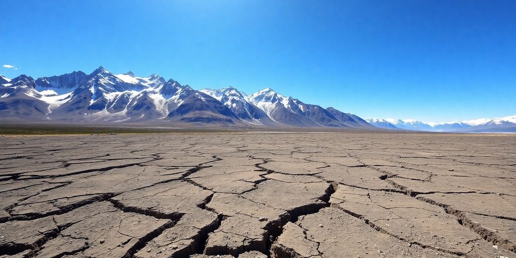
The sheer force of the 1964 Alaska earthquake dramatically altered the Alaskan landscape. Vertical displacements reached up to 38 feet in some areas, creating cliffs where flat ground once existed. The coastline itself was reshaped, with some sections rising while others submerged. One area shifted a staggering 50 feet towards the coast. This ground deformation caused substantial damage to anything built upon it.
Liquefaction was another major problem. Imagine the ground turning to quicksand; that’s essentially what happened. Buildings sank, and the ground became unstable.
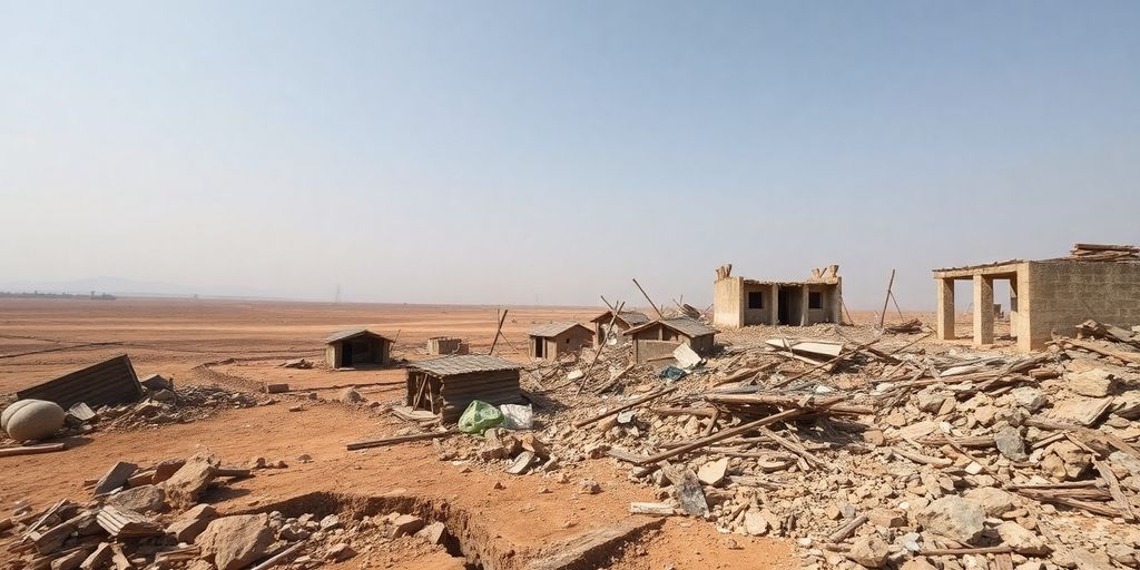
Infrastructure Collapse and Utility Disruptions
Buildings didn’t stand a chance. The earthquake’s intensity led to widespread infrastructure collapse. Gas, water, sewer, and electrical lines were severed, leaving communities without essential utilities. You won’t find many old buildings in Anchorage or Seward because of the earthquake. Almost all of the infrastructure had to be rebuilt from scratch. The earthquake’s epicenter, a mere 78 miles from Anchorage, amplified the devastation in Alaska’s most populated region. The Prince William Sound area was also severely impacted.
The Eerie Sound of the Alaska Earthquake
Many survivors recall a distinct and unsettling sound during the earthquake. People described the earth as "ringing like a bell." This wasn’t some metaphorical bell; it was the actual sound of the tectonic plates grinding against each other deep beneath the surface. It’s a sound that stuck with people, a constant reminder of the earth’s raw power. The duration of the quake, over four and a half minutes, only amplified this terrifying experience. The ground failures were a sight to behold.
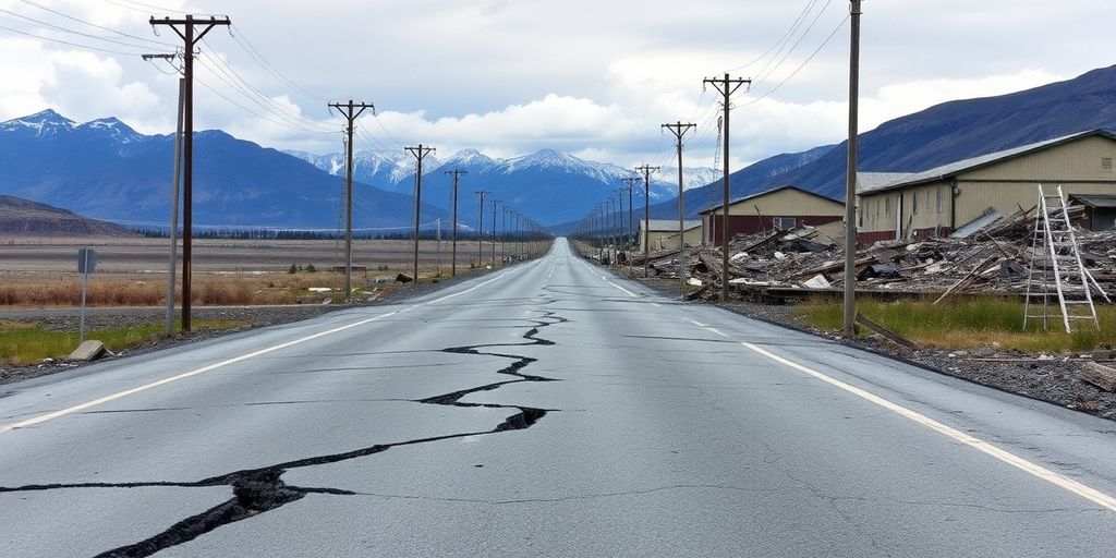
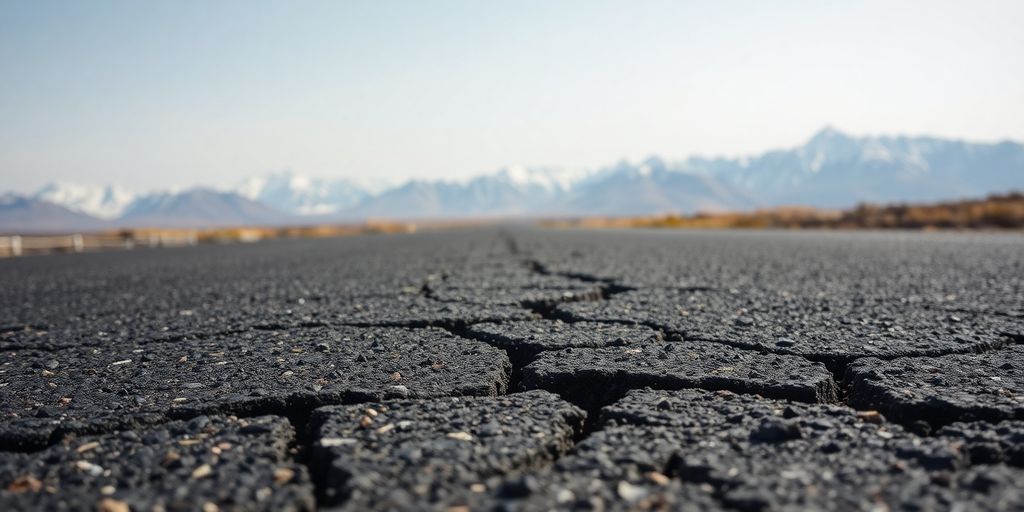
The earthquake was so intense that paved roads undulated like a slinky. The ground literally cracked open in places. It was something out of a movie, but it was real life for Alaskans on that day.
Human Toll and Community Relocation
Fatalities from the Alaska Earthquake and Tsunamis
The 1964 Alaska earthquake, despite its immense magnitude, resulted in a surprisingly low direct death toll. Nine people died as a direct result of the shaking ground. However, the tsunamis triggered by the quake caused widespread devastation and loss of life far beyond Alaska. Globally, the tsunamis claimed 122 lives. The low number is attributed to the fact that the earthquake occurred on a holiday in a sparsely populated region. The flood risks in the Pacific Northwest were drastically elevated.
Relocation of Valdez and Other Communities
One of the most significant consequences of the earthquake was the need to relocate entire communities. Valdez, built on unstable sand and gravel, suffered severe soil liquefaction. Much of the town slumped into the Valdez Inlet, triggering a massive localized tsunami. The oil storage tanks ruptured, causing a huge fire. The town was eventually moved to a more stable location a few miles away. You can find coastal subsidence information here. Other communities, like Chenega, were devastated, losing a significant portion of their population and requiring extensive rebuilding efforts. The story of Valdez is a stark reminder of the power of nature and the difficult choices communities face in the aftermath of such disasters. The displacement of indigenous coastal communities is a growing concern.
Rebuilding Efforts in Anchorage and Seward
Anchorage and Seward, two of Alaska’s largest cities at the time, sustained massive damage. In Anchorage, landslides caused by soil liquefaction destroyed entire neighborhoods, including the Turnagain area, where 75 homes were lost. Downtown Anchorage was also heavily damaged. Seward, a crucial port city, was ravaged by the earthquake and subsequent tsunamis. The rebuilding efforts in these cities were extensive, requiring a complete overhaul of infrastructure. You won’t find many old buildings in Anchorage or Seward because of the earthquake. Almost all of the infrastructure had to be rebuilt from scratch. The snow machine recovery was a challenge during this time.
The rebuilding process was a long and arduous task, requiring significant financial resources and a coordinated effort from local, state, and federal agencies. New building codes were implemented to ensure greater resilience to future seismic events. The experience shaped the development of these cities for decades to come, fostering a culture of preparedness and awareness of earthquake risks. The long-term impacts were significant.
Aftershocks and Ongoing Seismic Activity
Frequency and Magnitude of Initial Aftershocks
Following the massive 1964 Alaska earthquake, the region experienced a barrage of aftershocks. These aftershocks were not just minor tremors; many registered as significant earthquakes in their own right. In fact, within the first day alone, there were eleven aftershocks that exceeded magnitude 6.0. Imagine the constant shaking and the psychological impact on a population already reeling from the main event. It was a period of sustained anxiety and disruption, as people struggled to rebuild their lives amidst ongoing seismic activity. The frequency gradually decreased over the following weeks, but the initial intensity was truly remarkable. This period highlighted the sheer power unleashed by the megathrust earthquake.
Understanding Earthquake Swarms in Alaska
Alaska is no stranger to earthquake swarms, which are sequences of earthquakes that occur in a localized area over a relatively short period, without a clear mainshock. It’s different from the typical mainshock-aftershock pattern. The reasons behind these swarms are still not fully understood, but they are a fairly common occurrence across the state. For example, in 2014, a swarm near Noatak rattled residents with five magnitude 5.3-5.7 earthquakes spread out over two months. In 2015, a swarm off St. George Island shook the normally quiet Pribilofs. And in 2018, a swarm in the eastern Brooks Range accounted for more than 23,000 events. These swarms can vary greatly in magnitude, quantity, and duration, making them a fascinating and sometimes unsettling aspect of Alaska’s seismic landscape. It’s important to monitor recent volcanic seismicity to understand these patterns.
Notable Recent Seismic Events
Alaska remains one of the most seismically active regions in the world. While no event since 1964 has reached that earthquake’s magnitude, significant earthquakes are still relatively frequent. The 2002 Denali Fault earthquake, with a magnitude of 7.9, stands out as a major event in recent history. It caused substantial damage to infrastructure, including the Trans-Alaska Pipeline. The Minto Flats Seismic Zone is another area of ongoing activity, contributing to the state’s high earthquake count. These events serve as constant reminders of the geological forces at play and the need for continued monitoring and preparedness. The state’s unique position on the Pacific Ring of Fire means that Alaskans must always be ready for the next big shake. It’s why Heli Alaska is prepared for anything.
Living in Alaska means living with earthquakes. It’s part of the landscape, and while it can be unnerving, it also fosters a sense of resilience and preparedness. We know that another big one is inevitable, and we’re constantly working to improve our understanding of these events and how to mitigate their impact.
The Alaska Earthquake’s Impact on Science
The 1964 Alaska earthquake wasn’t just a disaster; it was a massive, real-world experiment that shook the scientific community. It provided a wealth of data and observations that scientists are still analyzing today. It really changed how we understand earthquakes and their effects.
Advancements in Understanding Soil Liquefaction
Before 1964, soil liquefaction was a known phenomenon, but the Alaska earthquake showed just how devastating it could be on a large scale. The widespread damage caused by liquefaction forced engineers and scientists to rethink how they assessed soil stability in earthquake-prone areas.
New Insights into Fault Rupture
The sheer size of the Alaska earthquake’s fault rupture provided scientists with unprecedented data. It helped them develop better models of how faults break and how energy is released during major seismic events. Observations of the effects of the tsunami are still targets for inundation modeling. The earthquake serves as the model for a lot of ongoing work trying to understand fault rupture.
Improved Tsunami Inundation Modeling
The tsunamis generated by the 1964 earthquake caused widespread destruction and loss of life. This spurred significant advancements in tsunami inundation modeling. Scientists realized they needed better tools to predict how tsunamis would behave and where they would hit hardest. The earthquake highlighted the need for more sophisticated models that could account for complex factors like seafloor topography and coastal geography. The Alaska Earthquake Center plays a key role in this.
Shaping Alaskan Society and Culture
Collective Memory of the Alaska Earthquake
The 1964 Alaska earthquake is more than just a historical event; it’s woven into the very fabric of Alaskan identity. It’s a shared experience that transcends generations, shaping how Alaskans perceive and prepare for future seismic events. You’ll find that many people still talk about where they were when it happened, passing down stories and lessons learned. This collective memory acts as a constant reminder of the power of nature and the importance of preparedness. It’s like a family story that everyone knows, a common ground that connects Alaskans across time.
Influence on Building Codes and Infrastructure
The earthquake prompted a major overhaul of building codes and infrastructure standards across the state. Engineers and policymakers recognized the need for structures that could withstand significant seismic activity. This led to the implementation of stricter regulations for construction, especially in vulnerable areas. These changes weren’t just about buildings; they extended to utilities, transportation systems, and other critical infrastructure. The goal was to create a more resilient environment, one that could better withstand the impact of future earthquakes. The geological bulletin details some of these changes.
A Culture of Earthquake Preparedness
Alaska has cultivated a strong culture of earthquake preparedness. This isn’t just about having emergency kits; it’s about a mindset. Alaskans understand that earthquakes are a part of life, and they take proactive steps to mitigate the risks. This includes:
- Regular earthquake drills in schools and workplaces.
- Public awareness campaigns on earthquake safety.
- Well-marked tsunami evacuation routes in coastal communities.
- Community-based preparedness initiatives.
This culture of preparedness is a direct result of the 1964 earthquake. It’s a testament to the resilience and adaptability of the Alaskan people. They’ve learned from the past and are committed to building a safer future. This is not to say that everyone is perfectly prepared, but the awareness and commitment are definitely there.
It’s pretty cool to see how a single event can shape an entire culture. The earthquake definitely left its mark, and it’s something that Alaskans will never forget. The Alaska Earthquake Center plays a big role in keeping everyone informed and prepared. Even Heli Alaska contributes to safety by providing reliable charter services for remote areas, ensuring that even in challenging conditions, help can arrive when needed. They offer helicopter services for various needs, including emergency response. It’s all part of the Alaskan spirit of looking out for each other.
Modern Seismic Monitoring and Preparedness
Role of the Alaska Earthquake Center
The Alaska Earthquake Center AEC plays a vital role in monitoring seismic activity across the state. It’s the go-to place for all things earthquake-related in Alaska. They keep a close watch on the ground, tracking everything from tiny tremors to potentially dangerous events. The AEC also provides data and resources to researchers, emergency responders, and the public, helping everyone stay informed and prepared.
Rapid Reporting for Public Safety
When an earthquake hits, getting the word out fast is super important. Rapid reporting allows the public and emergency managers to assess the potential impacts. By measuring the shaking across the region, and even in buildings, we are able to assess the potential impacts and determine what type of emergency response is likely to be most effective. The breadth of our network—with monitoring stations located in cities, villages, and critical infrastructure from Southeast to the Bering Strait—demonstrates the reach of earthquake hazards as well as our commitment to minimizing those hazards for all Alaskans. The USGS monitors earthquakes and reports on their impacts.
Community Drills and Evacuation Routes
It’s one thing to know about earthquakes, but it’s another to be ready for one. That’s where community drills and evacuation routes come in. These drills help people practice what to do during an earthquake and ensure they know where to go to stay safe.
A culture of earthquake preparedness is essential in Alaska. Regular drills, clear evacuation routes, and public education campaigns are all part of making sure communities are ready to respond effectively when the ground starts shaking.
Here are some key components of community preparedness:
- Regular Earthquake Drills: Schools, workplaces, and community centers should conduct regular drills.
- Clearly Marked Evacuation Routes: Well-marked routes help people quickly and safely reach designated safe zones.
- Public Education Programs: These programs teach people about earthquake safety, including what to do during and after an earthquake.
- Emergency Supply Kits: Encouraging households to prepare emergency kits with essential supplies like food, water, and first aid items.
Reminders and Memorials of the Alaska Earthquake
Placards and Signs in Coastal Towns
If you ever find yourself traveling through coastal communities like Valdez or Cordova, keep an eye out. You’ll see placards and signs serving as reminders of the devastation caused by the 1964 earthquake. These aren’t just historical markers; they’re a way for these towns to remember and honor what they went through. It’s a pretty powerful experience to see these signs in coastal towns and imagine what it must have been like.
The Enduring Legacy in Alaskan Leadership
It’s wild to think about how many of Alaska’s current leaders were kids when the earthquake hit. The shared experience of that day shaped their perspectives and approaches to governance. They grew up understanding the power of nature and the importance of preparedness. This has definitely influenced how Alaska plans for the future, especially when it comes to infrastructure and emergency response. You can see the impact of the Alaskan leadership in the state’s building codes and disaster planning.
Historical Documentation and Archives
Alaska has done a solid job of preserving the history of the 1964 earthquake. There are tons of historical documents and archives filled with photos, videos, and personal stories from that time. These resources are super important for researchers, students, and anyone who wants to learn more about the earthquake and its impact. The Alaska State Museum is a great place to start if you’re interested in learning more. It’s all about making sure the lessons of the earthquake aren’t forgotten.
The earthquake is burned into Alaskans’ collective memories. Tsunami evacuation routes, weekly siren tests, and ShakeOut exercises mean more when neighbors still tell stories of where they were on 27 March 1964. Many children at play that afternoon are now Alaska’s political and business leaders. This knowledge came at a tremendous price, but its influence on the ensuing years of development is unmistakable.
Alaska’s Unique Seismic Landscape
High Frequency of Earthquakes in Alaska
Alaska is earthquake country, plain and simple. It’s not just the occasional tremor; Alaska experiences a high number of earthquakes every year. This is because of its location at the meeting point of major tectonic plates. You might feel a small one without even realizing it, and the larger ones? Well, they’re a part of Alaskan life. It’s something you get used to, but it also means preparedness is key. The state experiences frequent geological activity, including rising mountains, earthquakes, and volcanic eruptions, due to the Pacific Plate subducting beneath the North American Plate.
Global Significance of Alaskan Seismicity
Alaska’s earthquakes aren’t just a local issue; they have global significance. The sheer size of some Alaskan earthquakes means they can be detected worldwide, and they contribute to our understanding of how the Earth works. Studying these events helps scientists learn more about earthquake behavior, which can then be applied to other seismically active regions around the globe. It’s like Alaska is a natural laboratory for earthquake research. Alaska’s seismic activity, particularly along the Aleutian Arc, is characterized by historic volcanic eruptions.
The Denali Fault and Minto Flats Seismic Zone
Alaska has some specific areas that are particularly active. The Denali Fault is a major strike-slip fault, and it’s responsible for some big earthquakes, like the 2002 event. Then there’s the Minto Flats Seismic Zone, which is known for its frequent, smaller earthquakes. These zones are under constant monitoring because they pose a significant risk to infrastructure and communities. The vigor of these faults generally decreases toward the north, although the impact of this compression can be traced all the way into the Arctic Ocean. Southcentral Alaska experiences earthquakes due to various tectonic features.
Alaska is a land of extremes, and its ground is always moving! Earthquakes are a regular thing here, shaping the land in amazing ways. From tiny tremors to big shakes, these movements show how powerful nature can be. Want to learn more about how Alaska’s unique geology affects everything from its mountains to its glaciers? Check out our website for more cool facts and even book a flightseeing tour to see it all from above!
Wrapping Things Up
So, what’s the big takeaway from the 1964 Alaska earthquake? It really changed how people in Alaska think about earthquakes. Before, maybe folks didn’t really get how powerful these things could be. But after that day, with buildings falling down and the ground literally changing, everyone got it. It was a tough lesson, for sure, but it made Alaskans super aware of the ground they live on. Now, you see things like tsunami routes and earthquake drills, and it all makes sense because people remember what happened. It’s like, they know earthquakes are just part of living there, and they’ve learned to live with that reality.
Frequently Asked Questions
How powerful was the 1964 Alaska earthquake?
The 1964 Alaska earthquake was incredibly strong, measuring a 9.2 on the moment magnitude scale. It was the most powerful earthquake ever recorded in U.S. history and the second strongest worldwide. It lasted for a long time, about four and a half minutes, which added to the damage.
What caused the 1964 Alaska earthquake?
This earthquake happened because of something called a megathrust. This is when one huge piece of the Earth’s crust, the Pacific plate, slid underneath another, the North American plate. This kind of event only happens in special areas called subduction zones, which are common around the Pacific Ocean, like in Alaska.
What were the immediate effects of the earthquake?
The earthquake caused a lot of damage. The ground shook so violently that in some places, it acted like quicksand, a process called liquefaction. Roads and buildings crumbled, and gas and water lines broke. Many people remembered a strange ringing sound, which was actually the Earth’s plates grinding together.
How many people died, and what happened to the towns?
Sadly, about 139 people died because of the earthquake and the tsunamis it caused. Some towns, like Valdez, were so badly damaged they had to be moved to new, safer locations. Many buildings in cities like Anchorage and Seward were completely destroyed and had to be rebuilt from scratch.
Did more earthquakes happen after the main one?
After the main earthquake, there were many smaller earthquakes called aftershocks. On the very first day, there were eleven aftershocks that were stronger than a 6.0 magnitude. Alaska also experiences ‘earthquake swarms,’ which are groups of many earthquakes that don’t always have one main big quake.
How did this earthquake help science?
The 1964 earthquake taught scientists a lot. They learned more about how soil liquefaction works, which is when wet ground turns to liquid during shaking. They also gained new insights into how faults break and how to better predict tsunami flooding.
How did the earthquake change life in Alaska?
The earthquake deeply affected Alaskans. It made them very aware of how powerful earthquakes can be. This led to stronger building codes and a culture where people are more prepared for earthquakes, with regular drills and evacuation routes.
Why does Alaska have so many earthquakes, and what is being done about it?
Alaska is a very active earthquake zone, experiencing many quakes each year. The Alaska Earthquake Center keeps a close eye on all this activity. They provide quick information to the public and emergency workers to help keep people safe.