Ever asked yourself how far is Alaska from Russia? It’s a question that sparks curiosity, thanks to the unique geography of the Bering Strait. This narrow stretch of water separates two vastly different worlds, yet they’re incredibly close in some spots. Let’s dive into the details and uncover some fascinating facts about this unusual connection.
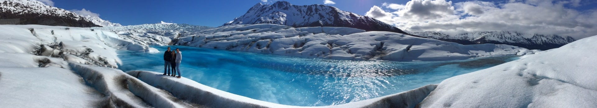
Tip: The best way to truly appreciate Alaska’s remote landscapes is from the air. Check out our Alaska flightseeing tours to see these breathtaking views for yourself.
Key Takeaways
- At their nearest point, Alaska and Russia are just 2.4 miles apart, separated by the Bering Strait.
- The two Diomede Islands—Little Diomede (U.S.) and Big Diomede (Russia)—sit in the middle of the strait.
- The mainland distance between the two countries is about 55 miles at its shortest.
- During winter, an ice bridge sometimes forms, making crossings possible, though not legally permitted.
- On clear days, it’s possible to see Russia from certain vantage points in Alaska.
Where Do Alaska and Russia Meet?

Understanding the Bering Strait
The Bering Strait is a narrow waterway, only about 55 miles wide, separating Alaska and Russia. This strait connects the Arctic Ocean to the north and the Bering Sea to the south. Its strategic location makes it a vital point for marine life and human exploration. During winter, the strait often freezes over, creating a temporary ice bridge that has historically allowed migration between continents.
The Role of the Diomede Islands
In the middle of the Bering Strait lie the Diomede Islands: Big Diomede (part of Russia) and Little Diomede (part of the U.S.). These islands are only 2.4 miles apart, making them the closest physical connection between the two nations. Big Diomede is uninhabited, while Little Diomede is home to a small indigenous community. Interestingly, the International Date Line runs between the islands, meaning they are almost a day apart in time despite their proximity.
Key Landmarks on Both Sides
On the Alaskan side, Cape Prince of Wales marks the westernmost point of North America, while Russia’s Cape Dezhnev is the easternmost point of the Eurasian continent. These landmarks are separated by the Bering Sea, a region known for its rich biodiversity and harsh weather conditions. Together, they frame a unique geographical and cultural boundary.
How Far Is Alaska From Russia?
Measuring the Closest Distance
At their nearest points, Alaska and Russia are separated by the Bering Strait, a narrow stretch of water that connects the Pacific Ocean to the Arctic Ocean. The shortest distance between the two lands is just 55 miles (88.5 kilometers), measured between mainland Alaska and Cape Dezhnev in Russia. However, the closest physical points are actually between two small islands within the strait: Little Diomede (U.S.) and Big Diomede (Russia). These islands are only 2.4 miles (3.8 kilometers) apart, making this one of the most fascinatingly close international divides.
The 2.4-Mile Gap Between Islands
The Diomede Islands are a unique geographical feature of the Bering Strait. Little Diomede belongs to the United States, while Big Diomede is part of Russia. What’s truly intriguing is that this tiny gap of water also marks the International Date Line. So, while the islands are just a few miles apart, they are technically a day apart in time zones. In winter, the strait sometimes freezes over, creating a temporary ice bridge that has historically been used by adventurers to traverse the distance.
Mainland-to-Mainland Distance
When you look at the distance between the mainlands of Alaska and Russia, it’s a bit more expansive. From the Seward Peninsula in Alaska to the Chukotka Peninsula in Russia, the distance is approximately 55 miles. Unlike the islands, this stretch of water is often rough and difficult to cross. For most people, the only practical way to travel between these two points is by air. Flights between major hubs, such as Anchorage and Moscow, cover thousands of miles, but this route avoids the logistical challenges of crossing the Bering Strait directly.
Despite their proximity, the two regions feel worlds apart due to the harsh, remote conditions and the lack of consistent travel routes. This unique geographical relationship continues to captivate explorers and travelers alike.
Traveling Between Alaska and Russia
Flight Options Across the Bering Strait
Traveling from Alaska to Russia might sound straightforward, but it’s anything but. Direct commercial flights are rare, leaving travelers with limited options. Charter flights, however, do exist. For instance, a flight from Nome, Alaska, to Provideniya, Russia, takes about 1 hour and 15 minutes. If you’re heading from Anchorage to Petropavlovsk-Kamchatsky, expect a longer journey of approximately 10 hours and 30 minutes, including layovers. These flights aren’t frequent, so planning well in advance is key.
Challenges of Crossing the Ice Bridge
In the dead of winter, the waters between Alaska and Russia can freeze, creating a natural ice bridge. Adventurous souls have attempted to cross it on foot, but this is neither safe nor legal without proper permissions. The ice is unpredictable, and weather conditions can change rapidly. Even with modern equipment, the journey is fraught with risks, including thin ice and extreme cold. It’s an incredible feat, but not one to take lightly.
Legal and Logistical Considerations
Crossing the border between Alaska and Russia involves navigating strict legal requirements. A visa is mandatory for entry into Russia, and border controls are rigorous. There’s no physical road or bridge connecting the two countries, so spontaneous trips are off the table. Whether you’re flying or attempting a more unconventional route, thorough preparation is essential. Always check current regulations to avoid complications.
The History of Alaska and Russia’s Proximity
The Alaska Purchase and Its Impact
In 1867, the United States made a bold move by purchasing Alaska from Russia for $7.2 million, which came out to about two cents per acre. At the time, many critics called it “Seward’s Folly,” mocking Secretary of State William Seward for what they saw as a wasteful deal. However, the discovery of gold, oil, and other natural resources later turned Alaska into a priceless asset. Interestingly, Russia sold Alaska partly out of fear that they might lose it to Britain in a future conflict.
Cold War Dynamics in the Region
From the 1940s to the 1980s, the proximity between Alaska and Russia became a symbol of global tension. The Bering Strait, with its narrow 2.4-mile gap at the Diomede Islands, was more than just a geographical boundary—it was a frontline in the ideological battle between the U.S. and the Soviet Union. Alaska housed radar stations, air force bases, and other military installations to monitor Soviet activities. The Diomede Islands earned the nickname “The Ice Curtain,” representing a natural but heavily fortified divide between the two superpowers.
Cultural Exchanges Over Time
Long before modern borders, indigenous communities in Alaska and Siberia shared a rich history of interaction. They traveled across the Bering Strait, trading goods, stories, and traditions. Even during times of geopolitical tension, these cultural ties often persisted, showcasing a deep connection that transcends national boundaries. Today, efforts continue to celebrate and preserve this shared heritage, fostering a sense of unity despite the political divide.
The Diomede Islands: A Unique Connection

Little Diomede vs. Big Diomede
The Diomede Islands are an extraordinary pair of landmasses in the Bering Strait, separated by just 2.4 miles of water. Little Diomede, part of the United States, is home to a small population of around 80 to 100 residents. This rugged island, less than 3 square miles in size, relies on a single heliport and sea routes for supplies. Big Diomede, owned by Russia, is larger at 4 square miles but remains uninhabited, housing only a weather station. Together, these islands highlight the stark differences yet intriguing proximity between the two nations.
The International Date Line’s Role
What makes the Diomede Islands even more fascinating is the International Date Line that runs between them. This imaginary boundary creates a time difference of almost 24 hours, earning them the nickname “Tomorrow Island” (Big Diomede) and “Yesterday Island” (Little Diomede). Standing on one island, you can literally see “tomorrow” across the water—a surreal reminder of how geography and time zones intersect.
Seasonal Ice Bridges
During harsh winters, the water between the islands sometimes freezes, forming a natural ice bridge. While this might seem like a tempting route for adventurous crossings, the ice is treacherous, prone to breaking and shifting. Locals have historically used this frozen connection for practical purposes, but it’s a risky endeavor. Today, most travel between the islands is done by air, especially for essential services like supply delivery or emergencies.
Can You See Russia From Alaska?

Visibility on Clear Days
Believe it or not, there are spots in Alaska where you can actually see Russia, but it’s not as simple as standing on the mainland and looking out. The best chance for a clear view is from Little Diomede Island, located in the middle of the Bering Strait. On a clear day, the Russian island of Big Diomede, just 2.4 miles away, is visible from there. The weather plays a huge role, though. Fog, snow, or even just the wrong lighting can completely obscure the view.
Popular Viewing Spots
If you’re curious about the best places to catch a glimpse of Russia, Little Diomede Island is your top bet. This remote Alaskan island offers a unique vantage point for spotting Big Diomede. For those who aren’t up for such a remote adventure, the mainland won’t give you the same experience, but it’s still fascinating to know how close the two countries are at this point. Helicopter tours, like those offered by Heli Alaska, Inc., can also provide incredible aerial views of the area.
Myths and Realities
The idea that you can easily see Russia from Alaska has been exaggerated over time. While it’s true for specific spots like the Diomede Islands, it’s not the case for most of the state. The misconception probably gained traction because of how close the two nations are geographically, but the reality is that seeing Russia is a rare treat, not an everyday occurrence for Alaskans.
Standing on Little Diomede and gazing across the icy waters to Big Diomede is a surreal experience. It’s a reminder of how connected yet separate these two vast lands are.
Wildlife and Ecosystems Between Alaska and Russia
Marine Life in the Bering Strait
The Bering Strait is home to a fascinating array of marine species. Whales, seals, and walruses are common sights in these icy waters. Bowhead whales, for example, are known for their incredible longevity and ability to thrive in freezing conditions. The strait also supports various fish species, including salmon and pollock, which are vital not only to the ecosystem but also to local fishing communities.
Bird Migration Patterns
This region is a major stopover for migratory birds. Every year, millions of birds, such as puffins, auklets, and sandpipers, travel between Alaska and Russia. The migratory routes often overlap, creating a shared skyway that connects the two nations. Bird watchers flock to areas like Wrangel Island and the Alaskan coastline to witness these spectacular migrations.
Shared Environmental Challenges
The ecosystems in this region face significant challenges, including climate change and pollution. Melting sea ice disrupts the habitat of polar bears and seals, while rising ocean temperatures affect fish populations. Both countries have a stake in addressing these issues, as the health of the Bering Strait impacts global biodiversity.
The Bering Strait is more than just a geographical boundary; it’s a dynamic ecosystem that ties Alaska and Russia together in unexpected ways.
Adventurous Crossings Between Alaska and Russia
Historic Ice Bridge Expeditions
Crossing the icy waters of the Bering Strait has always been a daring feat. During the colder months, when the water freezes, an ice bridge forms between Alaska and Russia, connecting the Diomede Islands. Historically, indigenous communities have used these seasonal bridges for trade and communication. However, modern adventurers have also attempted crossings, some succeeding under extreme conditions. The ice bridge, while fascinating, is treacherous, with shifting ice and unpredictable weather posing constant threats.
Modern-Day Challenges
Today, crossing the Bering Strait is no less difficult. The journey involves battling freezing temperatures, strong currents, and legal hurdles. Travelers need to navigate international borders, which means obtaining proper permissions and visas. Many who attempt crossings face logistical challenges, such as securing support teams or emergency evacuation plans. Without these, the risk of hypothermia or getting stranded is very real.
Stories of Successful Crossings
Despite the challenges, a few brave individuals have made the journey. For example:
- Lynne Cox, a swimmer, famously crossed the Bering Strait in 1987, swimming in water as cold as 42°F (5.5°C).
- The International Relay Swim Across the Bering Strait showcased teamwork and endurance over six grueling days.
- Adventurer Karl Bushby’s incredible trek across the ice highlighted both human determination and the dangers of such expeditions.
These stories remind us of the incredible spirit of exploration and the lengths humans will go to connect across borders.
The Strategic Importance of the Bering Strait
Military Significance
The Bering Strait has long been a focal point for military strategy between global powers. This narrow waterway, spanning just 55 miles at its narrowest point, acts as a natural chokepoint between Russia and the United States. During the Cold War, this proximity heightened tensions, as Alaska’s location made it both a strategic military asset and a potential vulnerability. Today, the region continues to play a critical role in Arctic security, with NATO and the U.S. working to deter Russian aggression in the area. Geopolitical dynamics and strategic competition in the Arctic further amplify the importance of this region.
Economic and Trade Routes
As climate change reduces Arctic ice, the Bering Strait is becoming increasingly navigable, opening up potential for new shipping routes. This development could transform the strait into a vital corridor for global trade, linking North America and Asia. However, the harsh Arctic conditions and seasonal ice still present challenges for year-round navigation. The Bering Strait’s emerging role as a critical chokepoint for shipping underscores its importance in global economic strategies. The Bering Strait’s significance in this context cannot be overstated.
Environmental Monitoring
The Bering Strait is not just a strategic point for military and economic interests—it’s also a hub for environmental research. The region is home to diverse marine ecosystems and serves as a migratory path for numerous species. Monitoring this area is essential for understanding the impacts of climate change on Arctic wildlife and ecosystems. Companies like HeliAlaska are contributing to this effort by providing aerial support for wildlife tracking and environmental surveys. Their specialized services help ensure minimal disruption to the fragile ecosystems in the region. HeliAlaska’s expertise highlights the importance of balancing development with conservation.
Cultural and Social Ties Across the Bering Strait

Indigenous Communities and Their Histories
The Bering Strait has long been a bridge—not just of geography but of culture. Indigenous groups, such as the Iñupiat and Yupik peoples, have lived on both sides of the strait for thousands of years. Their shared history predates modern national borders, with traditions, languages, and even family ties crossing what is now an international boundary. These communities have relied on the region’s unique ecosystem for survival, hunting marine mammals and fishing in the icy waters. Seasonal migrations and trade routes between the two continents were common, further strengthening their connection.
Shared Traditions and Practices
Despite being separated by a political divide, Indigenous groups in Alaska and Russia maintain remarkably similar traditions. From dance and storytelling to the preparation of traditional foods like seal and fish, these practices reflect a shared heritage. For example, the Yupik-speaking peoples in Siberia and Alaska continue to use their common language to communicate and preserve their cultural identity. Traditional foods like seal and seafood remain central to their diets, underscoring their reliance on the Bering Sea’s resources.
Modern-Day Collaborations
Today, efforts are being made to reconnect communities across the Bering Strait. Cultural exchanges, joint festivals, and even academic collaborations aim to celebrate their shared heritage. However, challenges remain, such as navigating the legal and logistical barriers imposed by international borders. Programs focusing on Indigenous rights and environmental conservation often serve as a platform for collaboration, allowing these communities to address shared challenges like climate change and resource management. The economy of the northern Yupiit and Inuit also highlights how traditional practices continue to shape modern livelihoods, blending ancient knowledge with contemporary needs.
“The Bering Strait isn’t just a line on a map; it’s a living connection between cultures that have thrived here for millennia.”
Summary Table of Cultural Links
| Aspect | Alaska | Russia |
|---|---|---|
| Language | Yupik, Iñupiaq | Yupik |
| Traditional Foods | Seal, salmon, whale | Seal, fish, reindeer |
| Shared Practices | Hunting, storytelling | Hunting, storytelling |
| Modern Collaborations | Cultural festivals, trade | Academic research, trade |
The Role of Geography in Alaska-Russia Relations
How Proximity Shapes Policies
The geographical closeness of Alaska and Russia has undeniably shaped their policies over the years. The narrow Bering Strait, only about 55 miles wide at its closest, has served as both a bridge and a barrier. During the Cold War, this proximity turned Alaska into a critical military outpost for the U.S., complete with radar systems and air bases aimed at monitoring Soviet activity. Even today, this closeness influences defense strategies and international diplomacy, particularly in the Arctic region. Security remains a top priority, especially given the increasing focus on the Arctic’s untapped resources and trade routes.
Geopolitical Implications
The Bering Strait’s strategic importance has long been recognized. It’s not just a natural divide but a critical chokepoint for military and economic activities. For Arctic nuclear powers like Russia and the U.S., this region is a focal point for security concerns. The presence of NATO exercises in the Arctic highlights ongoing tensions and the need for readiness. Meanwhile, economic opportunities, such as shipping routes and resource exploration, are shaping modern strategies.
Tourism and Exploration
Geography also plays a role in fostering curiosity and exploration. The Bering Strait and the Diomede Islands are unique attractions for adventurers and history buffs alike. Seasonal ice bridges and the quirky time difference between Big and Little Diomede add an element of fascination. For those seeking an aerial view, companies like Heli Alaska offer flightseeing tours that provide a breathtaking perspective of this rugged terrain, blending adventure with an appreciation for the region’s natural beauty.
The geography of Alaska and Russia doesn’t just separate them; it connects them in ways that influence policies, economies, and even personal stories of exploration. It’s a reminder of how the land beneath our feet shapes the world above it.
Fun Facts About the Alaska-Russia Distance
The Quirks of the International Date Line
Did you know that the International Date Line runs right between Alaska and Russia? This means that when you stand on Little Diomede Island in Alaska, you’re looking 20 hours into the future at Big Diomede Island in Russia. It’s a fascinating twist of time zones that makes this region truly one of a kind.
Record-Breaking Swims and Expeditions
While the Bering Strait is known for its icy waters, some brave souls have actually swum across the gap. The shortest distance between the two nations is just 2.4 miles, but the freezing temperatures and strong currents make this feat nothing short of extraordinary. These daring attempts highlight the human spirit’s determination to conquer nature’s challenges.
Unusual Travel Stories
Traveling between Alaska and Russia isn’t your average trip. From sledding across seasonal ice bridges to kayaking through the narrowest parts of the Bering Strait, adventurers have found unique ways to make the journey. And let’s not forget the rare charter flights that take off from Nome, Alaska, giving a bird’s-eye view of this historic passage.
The proximity of Alaska and Russia serves as a reminder of how geography shapes not only borders but also human imagination and ambition.
Did you know that the distance between Alaska and Russia is only about 2.4 miles at its closest point? This fascinating fact highlights how close these two regions are, despite being separated by the Bering Strait. If you’re curious to learn more about Alaska’s stunning landscapes and unique adventures, visit our website for exciting flightseeing tours and activities!
Conclusion
When you think about it, the distance between Alaska and Russia is more than just a few miles of water—it’s a fascinating mix of geography, history, and culture. Whether it’s the narrow 2.4 miles between the Diomede Islands or the broader 55 miles across the Bering Strait, the connection between these two places is unique. It’s a reminder of how close yet far apart two countries can be. So, next time you look at a map, take a moment to appreciate this tiny stretch of ocean that has sparked so much curiosity and wonder over the years.
Frequently Asked Questions
How far apart are Alaska and Russia at their closest point?
At their closest point, Alaska and Russia are just 2.4 miles (3.8 km) apart, measured between Little Diomede Island (U.S.) and Big Diomede Island (Russia) in the Bering Strait. While the mainland-to-mainland distance is wider—about 55 miles—the Diomede Islands make the two countries seem much closer. On winter days when the strait freezes, this narrow gap can form a temporary ice bridge, though crossing it is dangerous and not legally permitted.
Can you see Russia from Alaska?
Yes, it is possible to see Russia from Alaska, but only in specific places. The clearest views are from Little Diomede Island, where Russia’s Big Diomede Island sits just 2.4 miles away across the water. On exceptionally clear days, residents and visitors can also sometimes see across the Bering Strait from Cape Prince of Wales on Alaska’s Seward Peninsula. However, fog, snow, and low light often obscure visibility, so spotting Russia isn’t an everyday occurrence.
Is it possible to travel between Alaska and Russia?
Yes, but it isn’t simple. Traveling between Alaska and Russia requires proper visas and must be done by air or authorized charter services. There are no bridges or roads across the Bering Strait. The most common route is a short flight between Nome, Alaska, and Provideniya, Russia, which takes about 1 hour and 15 minutes. In the past, some adventurers have attempted crossings on the frozen strait during winter, but these are unsafe, require special permissions, and are not a legal means of travel.
Why is the distance between Alaska and Russia so small?
The closeness of Alaska and Russia is due to the Bering Strait, a natural waterway only 55 miles wide at its narrowest point. Within this strait lie the Diomede Islands, which sit just 2.4 miles apart and highlight how unusually close the two continents are. This geography reflects the land bridge that once connected Asia and North America during the Ice Age, allowing ancient migrations of people and animals between the continents.
Are there flights between Alaska and Russia?
Yes, but options are limited. Direct commercial flights are rare, so most travelers rely on charter flights. The most well-known route is from Nome, Alaska, to Provideniya, Russia, which takes around 75 minutes. Longer journeys, such as from Anchorage to Petropavlovsk-Kamchatsky, usually require layovers and can take over 10 hours. Flight availability depends on seasonal demand and current regulations, so booking in advance and securing a Russian visa is essential.
What is the significance of the Diomede Islands?
The Diomede Islands—Little Diomede (U.S.) and Big Diomede (Russia)—are remarkable because they sit only 2.4 miles apart in the Bering Strait yet belong to two different nations. They are divided not just by water, but also by the International Date Line, making them nearly 20 hours apart in time zones. Little Diomede has a small Alaska Native community, while Big Diomede is uninhabited and used mainly for military and research purposes. Their unique location symbolizes how close, yet separate, Alaska and Russia remain.
Has anyone ever crossed from Alaska to Russia on foot?
Yes, though such crossings are rare and extremely dangerous. Adventurers have crossed the frozen Bering Strait during harsh winters when ice forms between the Diomede Islands. For example, in 1987, swimmer Lynne Cox swam from Alaska to Russia in icy waters, and several explorers have walked across ice bridges in extreme conditions. However, these feats are not legal travel routes, as the international border requires visas and official entry permissions.
What is the mainland-to-mainland distance between Alaska and Russia?
The distance between mainland Alaska and mainland Russia is about 55 miles (88.5 km), measured between the Seward Peninsula in Alaska and the Chukotka Peninsula in Russia. While this may seem small, the Bering Strait’s currents, weather, and ice make direct crossings nearly impossible for regular travel. Today, the practical way to connect the two regions is by air, since no bridge or tunnel links the continents.